At Hutton + Rostron, specialist building surveys and comprehensive investigations are carried out using a range of different technologies to provide the best possible information and advice to our clients. With the emergence of UAV (Unmanned Aerial Vehicle) technology and the development of increasingly sophisticated camera drones, our technical capabilities have been significantly enhanced.
We now routinely employ Drone Surveys to deliver safer, quicker and more accurate inspection results, with considerable efficiencies to be achieved for our clients. A recent Case Study shows H+R’s work to tackle dampness and decay in one of the oldest buildings in Glasgow.
Benefits of Drone Surveys
Traditional building defect reports and roof surveys rely on the use of ladders, scaffolding, platforms or aerial lifts to access hard-to-reach places. This comes with a raft of disadvantages in terms of time, cost and accuracy of data, as well as the obvious risks and dangers to both the building and personnel.
A Drone Survey offer a multitude of benefits compared with conventional surveying methods including:
Accurate data gathering
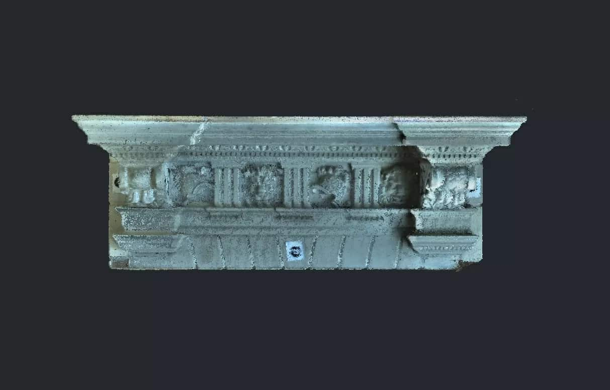
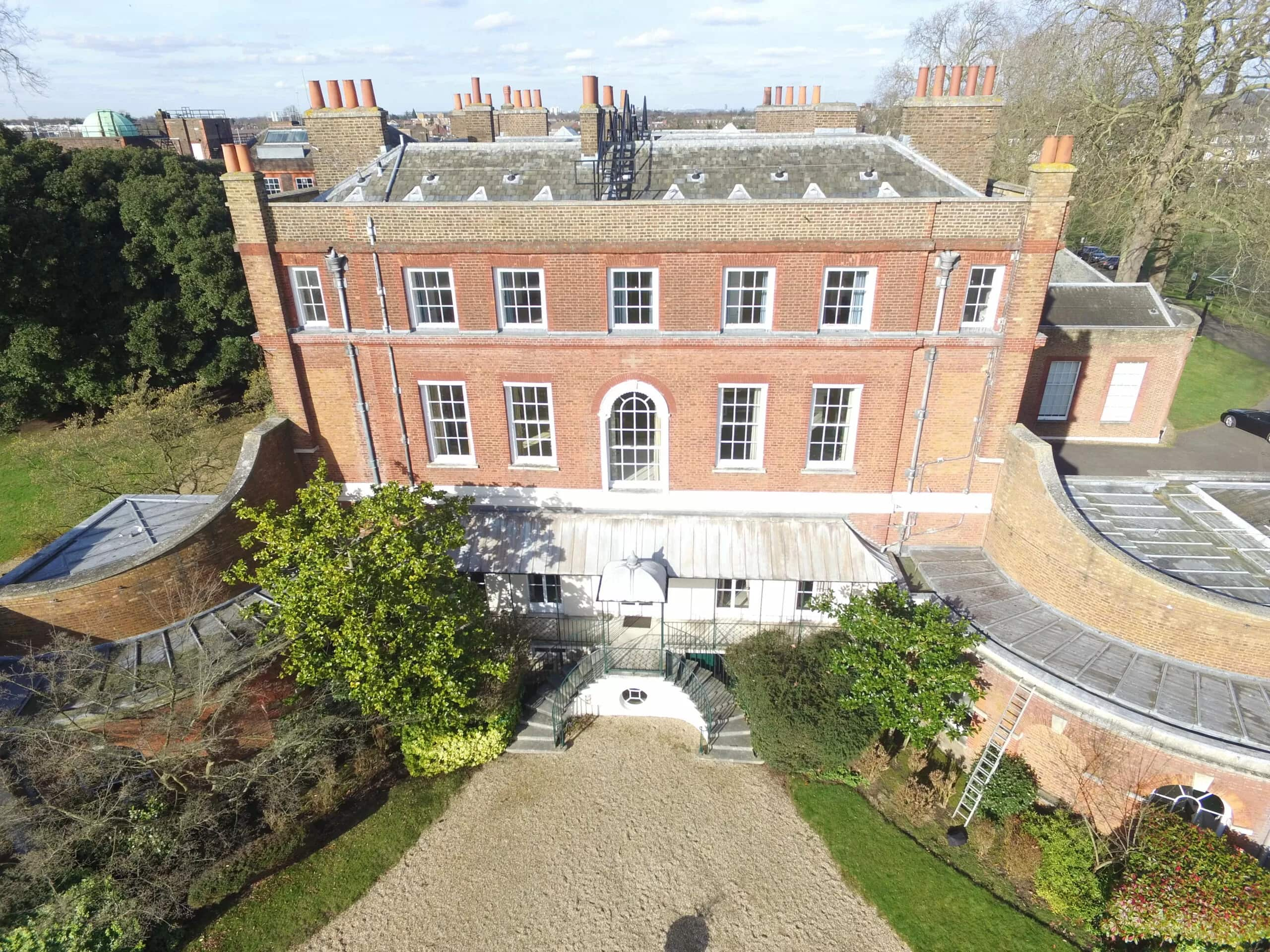
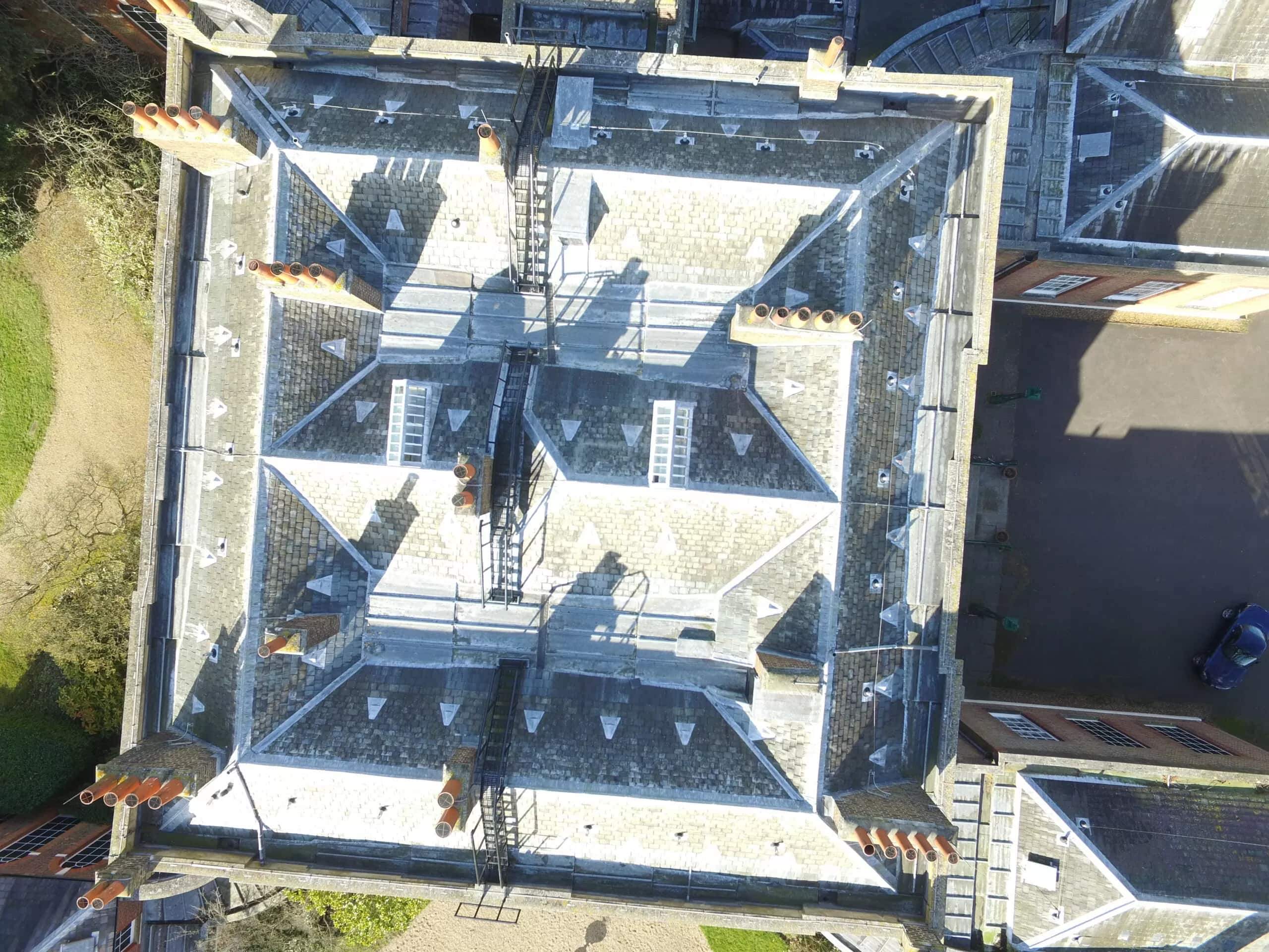
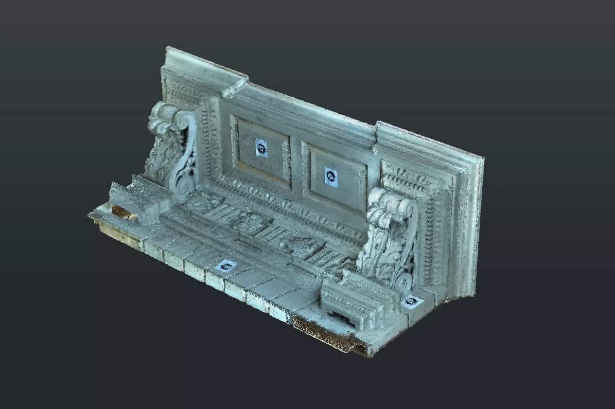
Substantial improvements in camera drone technology in recent years mean that it is now possible to take high-quality aerial photographs and high-resolution video footage to inspect building elements with astonishing accuracy. We employ drones for 3D imaging to create highly detailed 2D and 3D drawings as well as very accurate computer reproductions to aid our investigations. Images can be captured from a wide array of angles and elevations that would not be possible with handheld cameras, while GPS functionality can help record before and after shots.
Time and cost savings
A Drone Survey enables the inspection of tall building walls and roofs to be carried out much faster, and without incurring additional expenses associated with access equipment, manpower and time.
With the software taking autonomous control of the device to gather relevant building data, the impact of reducing the surveyor’s inspection time input can be significant. This can make aerial building surveys a superior, cost-effective option within the right framework.
Protection of vulnerable buildings
Drone Surveys collect data without leaving any physical impact on the building in question. Inspections are carried out from the air, with no physical equipment necessary other than the remote-controlled drone itself. This has clear advantages for architectural conservation and building pathology investigations of unstable or failing structures, as well as delicate surfaces that are susceptible to further damage or collapse, particularly in the heritage sector.
Improved personnel safety
Traditional building inspections of hazardous environments or high elevations and roofs always carry a small degree of risk, even when health & safety regulations for working at height are diligently complied with as a matter of course. Using a drone eliminates the need for surveyors to climb buildings, traverse unstable or slippery surfaces or face unexpected dangers, and they can easily reach blocked access areas that humans cannot.
Minimum operational disruption
Using drone technology to inspect building elements or elevations of a private home, public building or commercial premises offers maximum convenience for all concerned. Compared to the deployment of conventional equipment for high-access surveys, a drone makes no mess, no noise and causes no obstruction. This means that day-to-day operations on the ground can carry on as normal, unaffected by any building inspection.
Ground Penetrating Radar (GPR) Surveys
In addition to making full use of drone technology, we also value non-destructive site investigation techniques such as Ground Penetrating Radar (GPR), which can be used to map inaccessible or hidden voids within a property, detect buried utilities, map the position of reinforced concrete bars and other subsurface features.
GPR surveying uses radar pulses to image the subsurface, emitting safe, electromagnetic radiation (UHF/VHF) to detect signals from subsurface structures. It is an established geophysical technology and a non-intrusive, effective way to characterise the subsurface and investigate underground features.
FAQs
-
Why should I use a Drone Survey?
-
UAV technology is typically much cheaper than erecting access equipment or hiring a helicopter. Our sophisticated, battery-powered camera drones are relatively quiet and can fly close to buildings, delivering highly accurate data collected from any number of hard-to-reach places, saving our clients time and money while reducing potential risks to the building or the team.
-
Are Drone Surveys suitable for historic buildings?
-
Do you need to employ a licensed UAV operator?
-
What can Ground Penetrating Radar detect?
-
How does Ground Penetrating Radar (GPR) work?
View our Technology case studies:
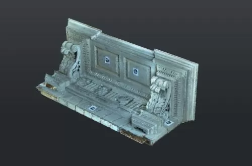
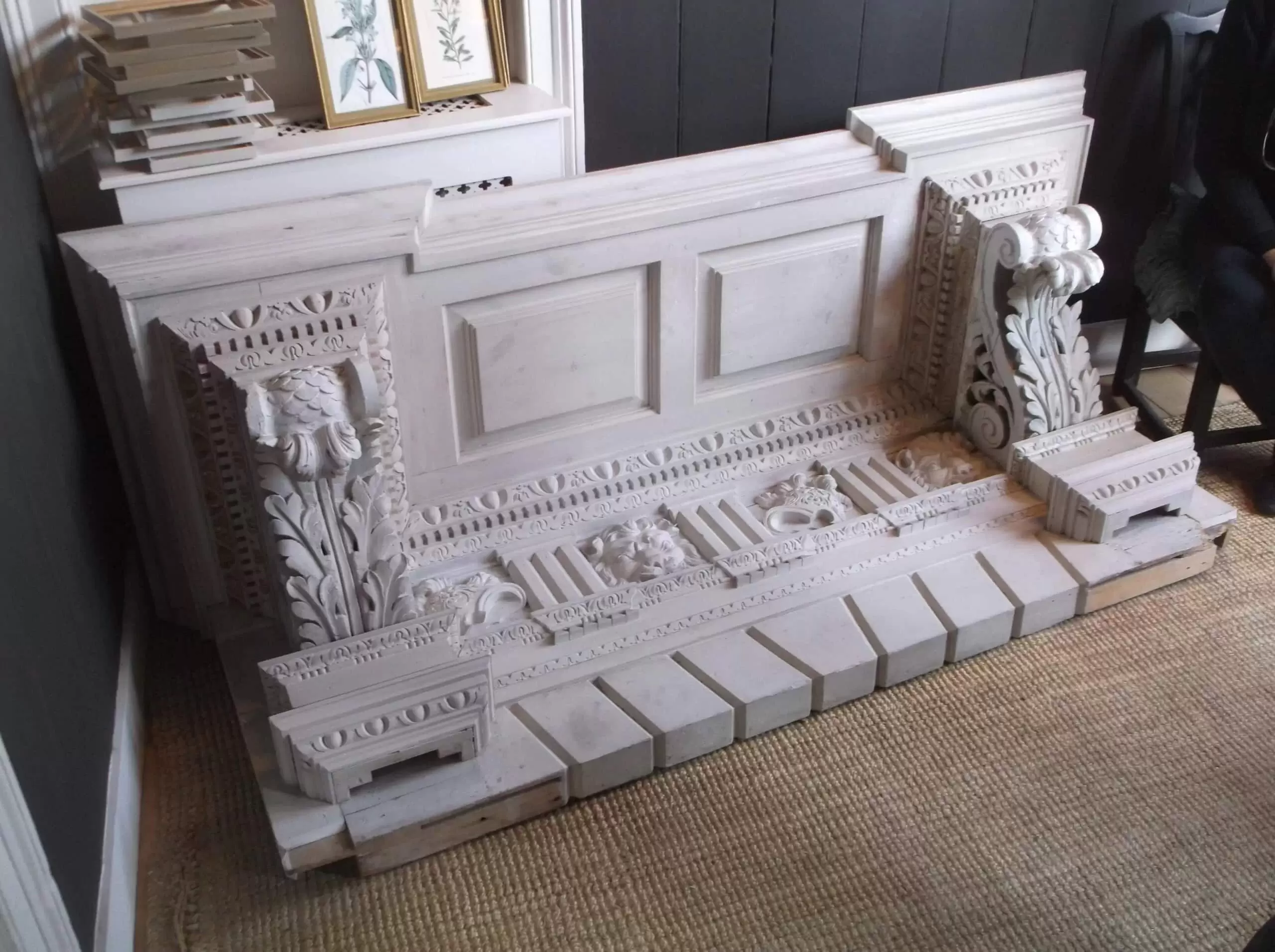
Frogmore Door Canopy
Technology Gallery
Need a Drone Survey?
Get in touch today
Main Office:
Netley House, Gomshall, Guildford, Surrey, GU5 9QA
Testimonials
I have known and seen work undertaken by Hutton+Rostron for over 20 years. I have always been impressed by their professional approach and depth of knowledge in the field of building surveys and pathology.
When it comes to seeking expert advice on the condition of the timber in an old building we turn to Hutton+Rostron whom we know we can rely upon to give a thorough and efficient appraisal which we can then use to develop the scope of the repairs.
We have worked with Hutton + Rostron over many years now, and find them knowledgeable, professional, helpful and practical. They understand both the needs of historic buildings and the forces driving their alteration, which means that their expert advice is always framed in a suitable way. We greatly enjoy our relationship with them, and look forward to many more years of collaboration.
H+R have provided a great service; I’m particularly happy with the high level of technical knowledge of their staff and willingness to take time to explain what they are doing and why. I thoroughly recommend them.
Squire and Partners have worked closely with Hutton + Rostron on a number of projects, including the UNISON Headquarters and 74 St James’s Street.
We have been impressed by their depth of knowledge of historic buildings and look forward to working with them again in the future.
Having worked as Project Manager on a number of high-value, listed houses, there is in my opinion clear benefit and value to a project in having H+R on board at the earliest stage possible.
Understanding the hidden condition of a historic building is crucial in making accurate budget and programme estimations. Hutton + Rostron provide an unrivalled service in this sector allowing us to make informed decisions and mitigate the risks of historic building fabric before they materialise. Hutton + Rostron have provided input on a number of Walton Wanger projects, providing us with a range of environmental investigations, which have enabled the design process and contract negotiations to be more accurate and more robust.
Hutton + Rostron and Sandberg have enjoyed a long standing and valued professional relationship and expect this to continue and develop in the future. Our work together ranges from the routine to the quirky, with the latter often being the most fascinating and therefore enjoyable!
Now that we have reached the end of the works at Great Portland Street, I would like to thank you and your team for all your efforts. The reports on existing condition provided by the team at Hutton + Rostron were invaluable and helped us de-risk the project for GPE. Equally your assistance throughout the project where unforeseen issues arose was gratefully received.
A full service through pre-construction, construction and early occupation.
Get in Touch with H+R
For more information contact our team on 01483 203221 or request a call back by clicking on the button below.